 Fraunhofer Institute for Computer Graphics Research IGD
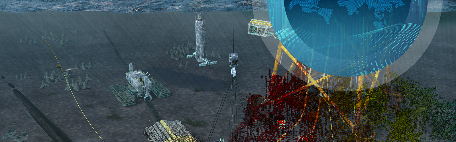
Start of project Marispace-X
Marispace-X: Launch of the largest European project for the digitization of maritime data
The stabilization of maritime climate, the servicing of offshore wind farms and the mapping of munitions dumps in the North and Baltic Seas all require one thing above all, namely comprehensive and publicly available data. With this need in mind, a consortium of which Fraunhofer IGD is a key member has now launched the largest European project for the digitization of maritime data. Today, the initiators were informed of the decision on funding for their application-oriented Cloud-based project – Smart Maritime Sensor Data Space X, or Marispace-X for short. Over the next three years, total funding of 15 million euros will be made available for research, development and implementation.
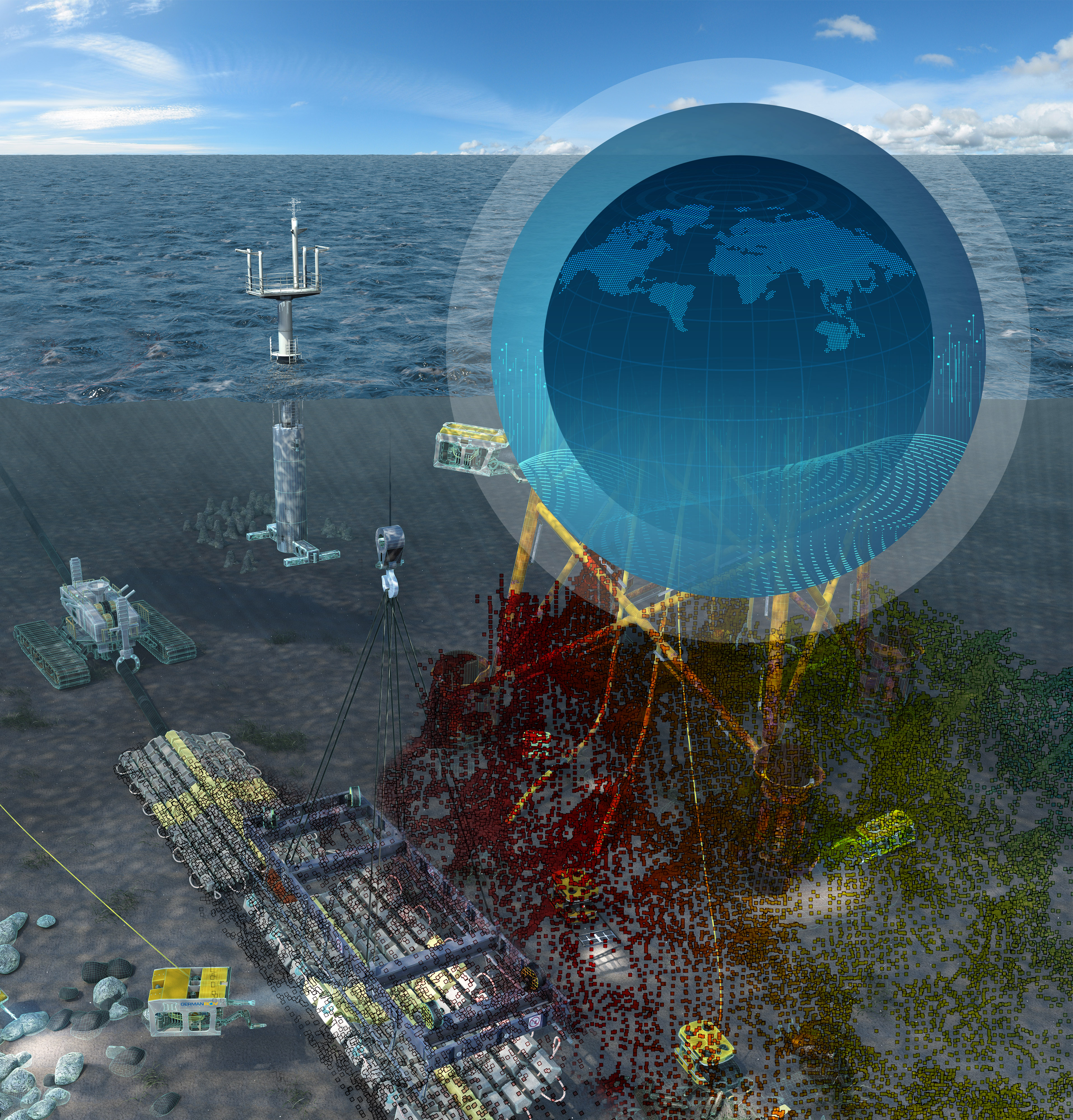
“Marispace-X will open up many new fields of application,” says Dr. Steffen Knodt, director of the Fraunhofer Sustainable Ocean Business performance center at the Fraunhofer Institute for Computer Graphics Research. “In doing so, this project will make a major contribution to the protection and sustainable use of the oceans in the context of the Blue Economy.” In addition to setting up this facility, all participants in the consortium have committed to making maritime information and geodata available and having it processed via intelligently networked sensors and data carriers (Internet of Underwater Things). For Knodt, this is a project with far-reaching implications: “We are in effect creating a digital twin of the seas and oceans.”
In order to implement the maritime digitization project, various players from science and research as well as business leaders have joined forces in a consortium. Other partners in addition to Fraunhofer IGD include the Christian Albrechts University in Kiel, the University of Rostock, the Helmholtz Center for Ocean Research (Geomar) and five private companies, namely TrueOcean, Stackable, MacArtney, Ionos SE and North.io. There are approximately 25 associate partners and ten maritime stakeholders who have given their backing to the application-oriented and industrial approach of the project. The Fraunhofer Sustainable Ocean Business performance center is involved as a transfer partner to industry.
According to Jann Wendt, managing director of North.io GmbH, the economic potential of the project is already apparent: “Together, we will create a virtual space for all available maritime data and thereby facilitate new business models.” To this extent, the digitization project can also be seen as a contribution to the European Union’s Green Deal aimed at shifting the economy towards greater sustainability. Furthermore, a European “Cloud” should make it possible to reduce dependence on American and Asian providers. This is also precisely the goal of the large-scale European Gaja-X project, which is intended to establish a powerful as well as secure data network in Europe in the coming years. “Marispace-X is the central maritime digitization project in Europe, with a focus on industrial applications,” says Wendt.
The coming months will see the creation of the technical prerequisites for the maritime Cloud to be used commercially. In the first phase of the project, Fraunhofer IGD in Kiel will be making available its expertise in Cloud computing as well as AI-based data analysis, data processing and data management to create a digital twin of the underwater world for real-time applications. To this end, the team based at the Kiel site is developing Gaia-X-compatible structures for recording and processing digital data, as well as integrating sensor technology to capture real-time underwater data.
Subsequent testing is planned at the Digital Ocean Lab off the coast of Rostock. The facility with its underwater test field will also serve as an experimental environment for Fraunhofer IGD’s partners. For example, the scientists can use bathymetry and soil morphology, satellite data and camera images as well as current, wave and weather data on site.
Contact:
Fraunhofer IGD – Kiel Kristine.Bauer@igd-r.fraunhofer
Fraunhofer IGD – Digital Ocean Lab Peter.Menzel@igd-r.fraunhofer.de http://www.igd.fraunhofer.de/dol-de
Fraunhofer IGD – Sustainable Ocean Business Steffen.Knodt@igd-r.fraunhofer.de